Wind, rain and cold: the weather engineering behind drone shows
Why ground forecasts understate wind at show height, what rain and cold do to drones, and how a proper go/no-go process keeps a show safe.

In this article 6 sections
A drone show date is fixed months in advance. The weather on that night is not. Choreography, permissions, music and audience can all be ready, and the show still depends on the air at 120 metres between, say, 21:00 and 21:20.
Weather gets less attention than it should in drone show planning, partly because nobody likes discussing cancellations. We design and fly show aircraft, and in our experience a good weather process is what separates operators who deliver from operators who get lucky. This article covers what wind, rain, cold, heat, fog and lightning actually do to a show fleet, and how a go/no-go decision should be made.
Wind: the number that decides most shows
Start with how wind is reported. A forecast or weather-station wind figure usually refers to 10 m above the ground. The UK Met Office, for example, mounts its anemometers at the top of a 10 m mast and reports two separate numbers: the mean wind, averaged over ten minutes, and the gust, the highest three-second average in the period. A show fleet has to cope with the gusts, not just the mean.
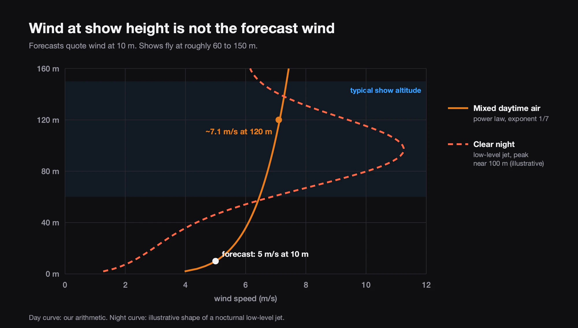
Second, wind generally gets stronger with height. A common engineering approximation is the wind profile power law, which scales a measured wind by the ratio of heights raised to an exponent, typically about 1/7 over open land in neutral conditions. On those assumptions, a 5 m/s wind at 10 m becomes about 7.1 m/s at 120 m and 7.4 m/s at 150 m. That is our own arithmetic, and it describes an average, well-mixed day.
Night is often worse, and shows fly at night. After sunset the ground cools and the air just above it decouples from the surface. NOAA-led measurements in Kansas found that the resulting nocturnal low-level jet often peaked at or just below 100 m above ground, most often at 7 to 10 m/s. The same study notes that weather models do not predict these low jets well. So a still, pleasant evening at ground level can still hide strong wind at exactly the height where the show flies.
Why a formation needs a power margin
To hold position in wind, a multirotor tilts into it and spends part of its thrust fighting the airflow. A show drone also has to move along its choreographed path, stay close to its planned position, and still have reserve for a gust. As wind rises, three things happen together: position error grows and shapes go soft at the edges, the batteries drain faster, and the margin for an unexpected gust shrinks. Hot air makes it worse. Warm air is less dense, and the US National Weather Service notes that in thin air a propeller produces less thrust.
That is why a wind limit is not just the aircraft’s rated figure. A sound limit starts from the manufacturer’s rating, then allows for gusts, the fastest moves in the choreography, battery state at the end of the show and air temperature, and it is applied to wind at show altitude. It belongs in the operator’s written procedures, agreed before the event, not chosen on the night.
Rain: rain-resistant is not waterproof
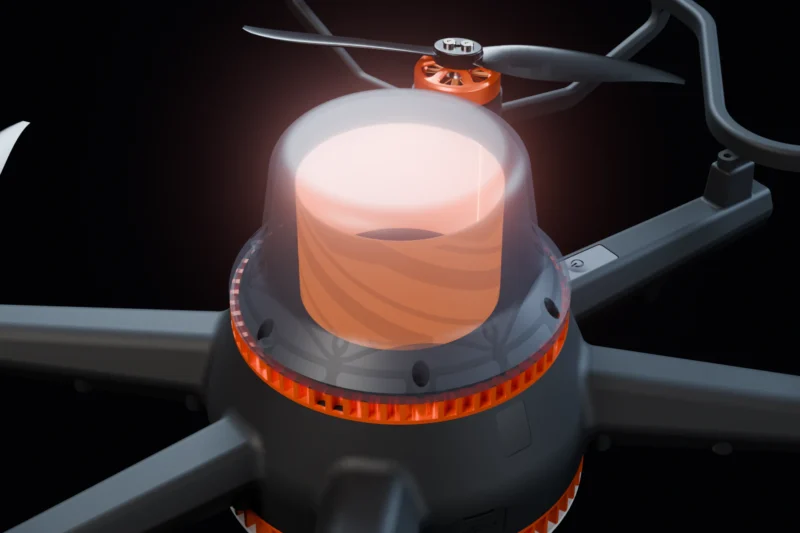
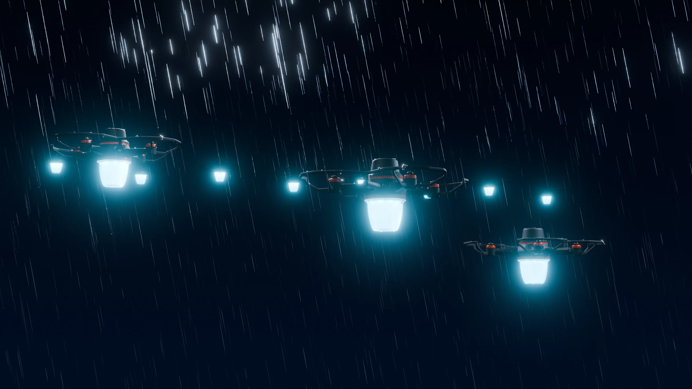
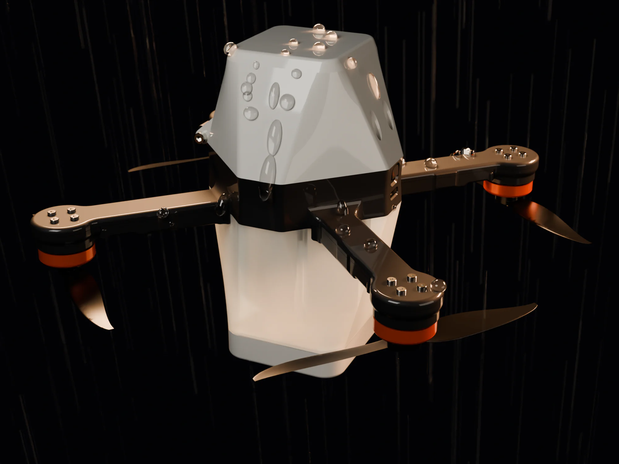
Water causes three kinds of trouble. Motors are exposed to the airflow by design, so water gets to bearings and windings; once may be harmless, but repeated wetting without drying leads to corrosion. Electronics and connectors can short or corrode where water collects. LEDs are affected optically: droplets on a diffuser scatter light, and rain in the air turns sharp points into soft glows, so images lose contrast even when every drone is healthy.
Manufacturers deal with this by keeping water away from what matters: closed shells, enclosed arms, sealed joints, protective coatings, and shapes that shed water instead of collecting it. An IP rating is something else. It is a code under IEC 60529 (EN 60529 in Europe) that says a product passed a defined test. RS Components’ summary notes, for example, that the IPX4 level means splashing from any direction, tested for at least 10 minutes, while higher levels cover water jets and immersion. Without a stated rating, “rain-resistant” means designed to tolerate rain within limits. It does not mean waterproof, and it does not mean flying through a downpour.
We design our own aircraft on that principle. NOVA has a rain-resistant airframe and is rated for 8 m/s wind, and GP4 2.0 has enclosed arms that make it more rain-resistant than the original GP4. Neither has an IP rating, and neither is meant to fly in storms. Light rain is a judgement call; heavy rain, especially with wind, is a stop. After any wet show, aircraft should be dried and inspected before they are charged or packed.
Cold and heat: batteries and LEDs
Cold is mainly a battery problem. Lithium-ion cells, including the lithium-polymer packs many drones use, lose usable capacity as they cool, because the electrolyte becomes more viscous and the chemical reactions slow. Battery University gives a rule of thumb that a battery delivering 100% at 27 °C will typically deliver only about 50% at -18 °C, and the loss recovers once the cell warms up. A 2022 review in Materials describes the mechanisms, including slower charge transfer and lithium plating during low-temperature charging.
Charging is the stricter limit. Battery University gives the permissible Li-ion charge range as 0 °C to 45 °C and warns that charging below freezing can plate lithium on the anode, permanently reducing performance and safety. In practice, a winter show needs batteries kept warm before flight, charged only once they are back above freezing, a shorter choreography or a larger reserve, and close attention to voltage under load during the first minutes. Check the operating temperature range in each aircraft’s specification before a cold-weather booking. Cold air does have one benefit: it is denser, so propellers produce a little more thrust.
Heat works the other way. Batteries deliver well when warm but age faster; Battery University reports cycle life roughly halved when charging and discharging at 45 °C. LEDs also suffer. The US Department of Energy notes that heat reduces LED output and shifts colour, with red and amber the most sensitive, so a hot fleet can drift off its designed colours. Drones waiting on a sunlit field before a summer show start warm. This is why NOVA has LED cooling and temperature monitoring that protects the LEDs.
Humidity, fog and low cloud
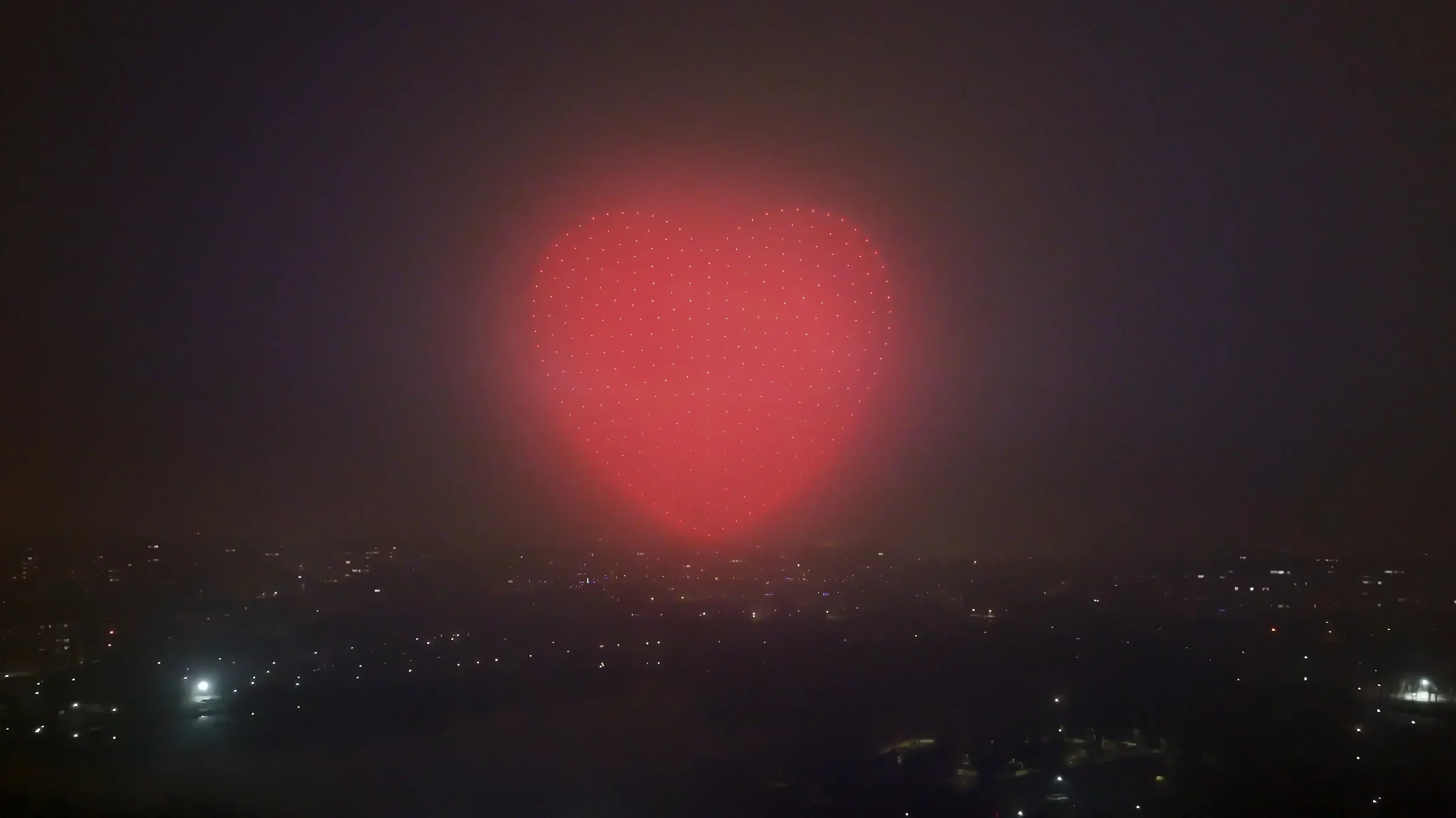
Visibility can end a show even in still, dry air. The Met Office defines fog as visibility below 1,000 metres, and radiation fog forms on clear, calm nights as the ground cools: the same nights that are best for wind. Haze and high humidity make images look washed out from a distance.
Low cloud is a harder limit. If the cloud base is below the top of the show, drones fly into it and images vanish into a glow. There is also a regulatory side. In the EU, a VLOS operation is defined as one where the remote pilot can keep continuous unaided visual contact with the unmanned aircraft. What that means for a particular show depends on the operator’s authorisation, so operators should confirm the conditions with their national aviation authority.
Lightning: a hard stop
Thunderstorms are the one weather threat where there is nothing to debate. NOAA notes that lightning can strike more than 10 miles (about 16 km) from where rain is falling, that any audible thunder means you are within striking distance, and that people should stay in shelter until 30 minutes after the last thunder. The National Weather Service gives the same 30-minute rule. Counting seconds between flash and thunder and dividing by three gives an approximate distance in kilometres.
For a show this has two consequences. The crew on an open launch field must stop work and shelter, whatever the drones could tolerate. And because the 30 minutes count from the last thunder, a slow-moving storm can use up the whole show window. Storms also bring gust fronts, sudden strong winds that sometimes arrive ahead of the rain.
The go/no-go process
Good weather decisions come from a process agreed in advance.
- Watch the forecast window early. From about a week out, follow the trend for wind at the surface and at higher levels, rain, cloud base, visibility, temperature and thunderstorm risk, and share it with the event producer.
- Set the limits in writing. Maximum mean wind and gust at show altitude, minimum cloud base and visibility, temperature range, rain tolerance and lightning distance, all taken from the aircraft specifications and the operator’s procedures.
- Measure on site, at height. An anemometer on a mast at the launch site, plus wind information from show altitude: a test aircraft held at show height, or a wind-profile instrument at larger events. Compare what you measure with the forecast.
- Fix decision points. For example the day before, a few hours before, and just before launch, each made by one named person with the authority to say no.
- Plan holds. Decide how long the show can wait for a squall to pass, given battery state, crew hours, the audience and the airspace window.
- Put the backup in the contract. A backup date, a clear weather clause, who makes the call, and what happens commercially if the show is postponed. Take proper legal advice on the wording.
A weather call should be made in advance, by a named person, against written limits. It should never be an argument on the field five minutes before launch.
None of this is glamorous, but it is what lets a show fly safely on the nights it can, and stand down cleanly on the nights it can’t. If you are building an operation and want help writing weather procedures into your operations manual, our training and consulting team can help.