GNSS jamming and drone shows: what fails and how to fail safe
How RTK positioning holds a drone formation together, why weak interference breaks it, what has really happened at shows, and how to engineer a safe fallback.

In this article 7 sections
Show drones do not see each other. Each aircraft flies to a list of positions in time, and the formation exists only because every drone knows, to within a few centimetres, where it is. Almost all of that knowledge comes from satellites. When satellite positioning is jammed, spoofed or simply degraded, a formation can blur, collapse or, in the worst cases, come down.
No drone is immune to this, ours included. What engineering can do is make a fleet notice the problem early, keep flying sensibly for a few seconds, and fail safe when it cannot continue. This article explains how, starting with how the positioning works.
How a show drone knows where it is
GNSS is the family name for satellite navigation systems: GPS, Galileo, BeiDou and GLONASS. A receiver measures its distance to several satellites at once by timing their signals, and solves for its position. On its own, the code a receiver tracks gives position errors of around a metre, according to the European Space Agency’s Navipedia. That is fine for a car, and far too coarse for drones flying in a tight formation.
RTK, real-time kinematic positioning, is how shows get to centimetres. A base station on a surveyed point sends its own measurements to every drone over a radio link. Each drone then compares not just the codes but the carrier waves themselves. The carrier is a radio wave with a wavelength of about 20 cm on GPS L1, and a receiver can measure where it is in that wave to within a few millimetres. The catch is that the receiver cannot directly tell how many whole wavelengths lie between it and the satellite. Working that integer out is called ambiguity resolution. While the integers are only estimated, the receiver is in “float” mode, good to decimetres. Once it has fixed them, it is in “fix” mode, good to a few centimetres.
For a formation, that difference is everything. Drones fly close together and pass through each other’s paths. Decimetres of error, or a sudden jump while the receiver re-solves, eats into the separation the choreography was designed around.
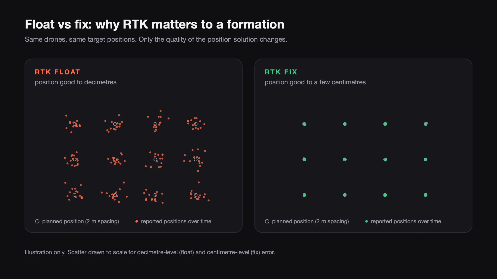
Why weak interference breaks RTK first
GNSS signals arrive at the ground weaker than the receiver’s own thermal noise; receivers dig them out by correlating against a known code. A peer-reviewed study in Sensors (2021) describes the satellite’s transmitted power as reduced by many orders of magnitude on the way down. Anything that raises the noise floor in the GNSS band, a jammer or an unintentional emitter, eats directly into that margin.
Carrier tracking is the most fragile part. The same Sensors study exposed survey-grade and low-cost receivers to a commercially available in-car jammer; when positioning survived at all, it usually stayed in float mode instead of reaching a fix. That is the key point for shows: interference far too weak to stop a drone knowing roughly where it is can still knock it out of centimetre-level fix. Nature can do the same: during strong space weather, ionospheric scintillation can grow RTK errors from a few centimetres to around a metre, and shows have been cancelled minutes before the start because the drones could not get reliable positioning.
What incidents teach
Drone shows have lost aircraft to positioning problems: formations that broke apart mid-show, and fleets that came down after a strong radio signal was detected just before the performance. In most public cases the exact cause was never established. Shows have also been called off on the ground when space weather degraded positioning, which is exactly what should happen.
Not every fall is interference. Wind beyond an aircraft’s limits can look very similar from the crowd. Diagnose from logs, not from footage.
The background is getting noisier. EASA says GNSS jamming and spoofing have increased notably since February 2022 and is now on revision 4 of its safety information bulletin. In October 2026 its weekly list of the most affected flight information regions included Bucharest, Warsaw, Tallinn and Vilnius.
Jamming, spoofing and the law
Jamming drowns the signal so the receiver loses lock. Spoofing transmits fake satellite signals so the receiver computes a confident but wrong position or time. For a show, jamming is the more common problem; spoofing is more dangerous, because a drone that believes a false position can also believe it is inside its geofence.
Both are illegal for the public. In the US, federal law prohibits operating, marketing or selling jammers, including GPS jammers, with fines, equipment seizure and criminal penalties. In Europe, CEPT Recommendation (04)01 records that jammers cannot be built to comply with EU equipment rules and recommends forbidding their sale and use outside narrowly authorised cases, and regulators such as Switzerland’s OFCOM note that possession is banned there as in EU countries. If you suspect interference at a venue, stop flying and report it to the national telecoms regulator and the aviation authority. Rules differ by country, so check with yours.
Defences on the aircraft
Multi-constellation, multi-band receivers. Tracking GPS, Galileo, BeiDou and GLONASS gives more satellites to choose from when some are blocked. Tracking more than one frequency band matters more: the in-car jammer in the Sensors study, for example, covered only the L1/E1 band, and modern signals such as GPS L5 sit in a protected aviation band with more power and wider bandwidth for better jam resistance. Dual-frequency tracking also allows the receiver to correct for ionospheric delay. Our NOVA uses multi-constellation GNSS with anti-interference and anti-jamming algorithms for exactly these crowded RF environments.
Antenna design. Reflections off buildings, water and stage structures corrupt positioning, they matter most for low satellites, and better antennas reduce them by rejecting signals from low-elevation directions. Quadrifilar helix antennas are a good fit here: they keep clean circular polarisation across a wide range of angles and work without a ground plane, and a well-designed one combines good multipath rejection with rejection of signals arriving low, which is also where ground-level interference comes from.
Interference detection and mitigation. Receivers can watch automatic gain control, signal-to-noise ratios and the agreement between constellations. A Stanford and University of Colorado team showed in GPS World that combining power metrics with GPS-versus-Galileo consistency flagged jamming and spoofing that either method alone would miss. Anti-jamming algorithms then filter what they can; detection tells the flight logic when they cannot.
IMU and magnetometer holdover. Inertial sensors keep estimating motion when GNSS drops out, but their errors accumulate quickly, roughly with the square or cube of time for short gaps. Redundant IMUs and magnetometers that cross-check each other buy seconds of stable flight. Seconds are enough to hold or descend safely, not enough to finish a show.
Defences on the ground
A site RF and GNSS survey. Before committing to a site, log satellite visibility, signal-to-noise and fix status at the launch area and across the show volume, at the time of night you will fly. Note broadcast masts, stage RF, LED walls and reflective surfaces, and choose the RTK base position with a clear sky view. Check the space weather forecast on the day.
A monitoring station. A fixed receiver at the site, logging interference metrics before and during the show, separates “the fleet has a problem” from “the site has a problem” and leaves evidence for investigators.
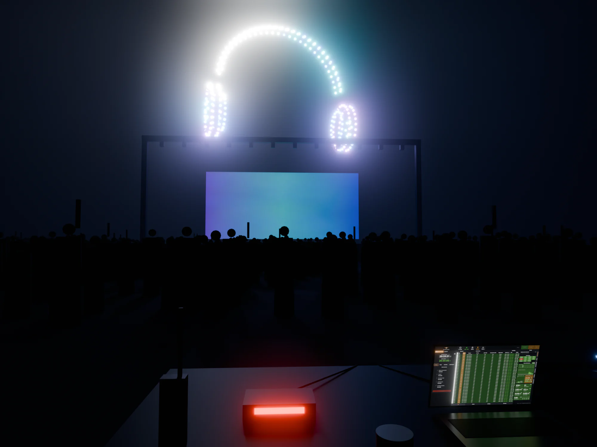
Go/no-go gates. Define in advance what fix rate and signal margin are required to launch, and hold the show if they are not met. PILOT shows RTK base status and correction-link levels across the fleet and will not authorise a show until every preflight check clears. A cancelled show is a safe show.
Failing safe
A degraded fleet should step down through predefined responses, decided in software before the show rather than improvised under pressure:
| What the fleet sees | Sensible response |
|---|---|
| Fix drops to float on a few drones | Flag them; hold or widen spacing if margins allow |
| Fleet-wide loss of fix or rising interference | Pause the show, hold, then land in a controlled way |
| GNSS lost on an aircraft | Inertial holdover, controlled descent inside the safe area |
| Aircraft approaching or crossing a boundary | Warning, then automatic failsafe, then termination as a last resort |
Geofences are the last line, and they are only as good as the position estimate behind them, which is why spoofing detection matters. PILOT layers soft, hard and ballistic geofences, physical and PIN-protected kill switches and automatic emergency response; the ballistic fence models the predicted impact zone and can trigger flight termination as a last resort. Build the fall zone with enough margin that a drone with a briefly wrong position still lands somewhere safe.
A good show system is not one that never loses its fix. It is one that knows when it has, and acts before the audience notices.
If you are planning shows in busy RF environments and want a second opinion on your site process, our operations team can help.